 Asset Publisher
LOCATION
 Lubsza. Fot. Paweł Mrowiński
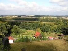
 Brody. Fot. Paweł Mrowiński
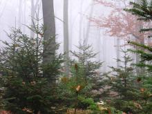
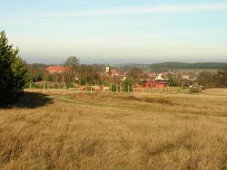
 Pejzaż terenów Nadleśnictwa Lubsko. Fot. Paweł Mrowiński
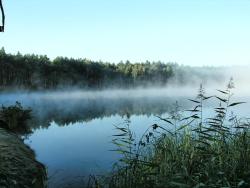 Jezioro śródleśne. Fot. Paweł Mrowiński
The Forest District Lubsko is one of 20 forest districts of Regional Directorate of the State forests in Zielona Góra. It administers on the area of over 32 thousand hectares (32.247,52 ha). The Forest District Lubsko is one of the biggest forest districts in Poland. The territorial range of the Forest Districts equals over 54 thousand hectares.
The whole area of the Forest District is located in the southern part of Zielona Góra Province (Lubusz Voivodeship), within the area of two ditrict, namely: Żary District and Krosno District. The western border constitutes almost twenty kilometres long section of Lusatian Neisse River.
Because of the high forestation rate (57,7%) of the area, the settlement network is rather rare. There are located two towns: Lubsko (over 15 thousand of inhabitants) and Jasień (about 5 thousand of inhabitants).
The area of the Forest District Lubsko is located in two nature and forest Lands (Wielkopolska and Pomerania Province, and Silesia Province) and counted among lowland areas. Part of the land is characterised with wavy and hilly sculpture of the terrain. The lowest point (55,6 meters above sea level) is located nearby the village Starosiedle, and the highest point (142,9 meters above sea level) is located nearby the town Jasień.
There goes the border of last glaciations through the territory of the Forest District, which separates the belt of the lake districts located in the north from the belt of the lowlands. There dominate rather poor, sandy soils created from postglacial sands and gravels (podsolic soils – 55,6%, rusty soils – 27,6%).
Temperate warm climate is characterised by temporary features between oceanic and continental climate. Spring and summer are early and long seasons, however winter is short and rather mild.
The weather is developed by polar and oceanic, and polar and continental air masses. There definitely predominate west winds. The average annual quantity of rainfalls equals 582 mm, while the average temperatures rates on the level of 8,32 oC. The growing season is long and lasts between 220 and 225 days.
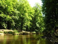
The whole area of the Forest District is located in Odra drainage basin in the Lusatian Neisse river basin and its tributaries. The main river is the River Lubsza running in the northern west direction. The hydrographic network includes also lakes, such as: Brodzkie (Parkowe), Żurawno, Płytkie, Głębokie, Niwa, Drutów, numerous Fish ponds and superficial reservoirs for fire protection use.